
- Part 2 - Carrizo Plain National Monument
- Part 3 - Death Valley
- Part 4 - Highway 178 & Around Kernville

The Display of Wildflowers Begins on Hwy-46
We continued on, stopping at many points when a pull off was available. The colors were mainly yellow and a burnt orange, the latter due to the vast fields of Fiddleneck.

Burnt Orange Fields of Fiddleneck
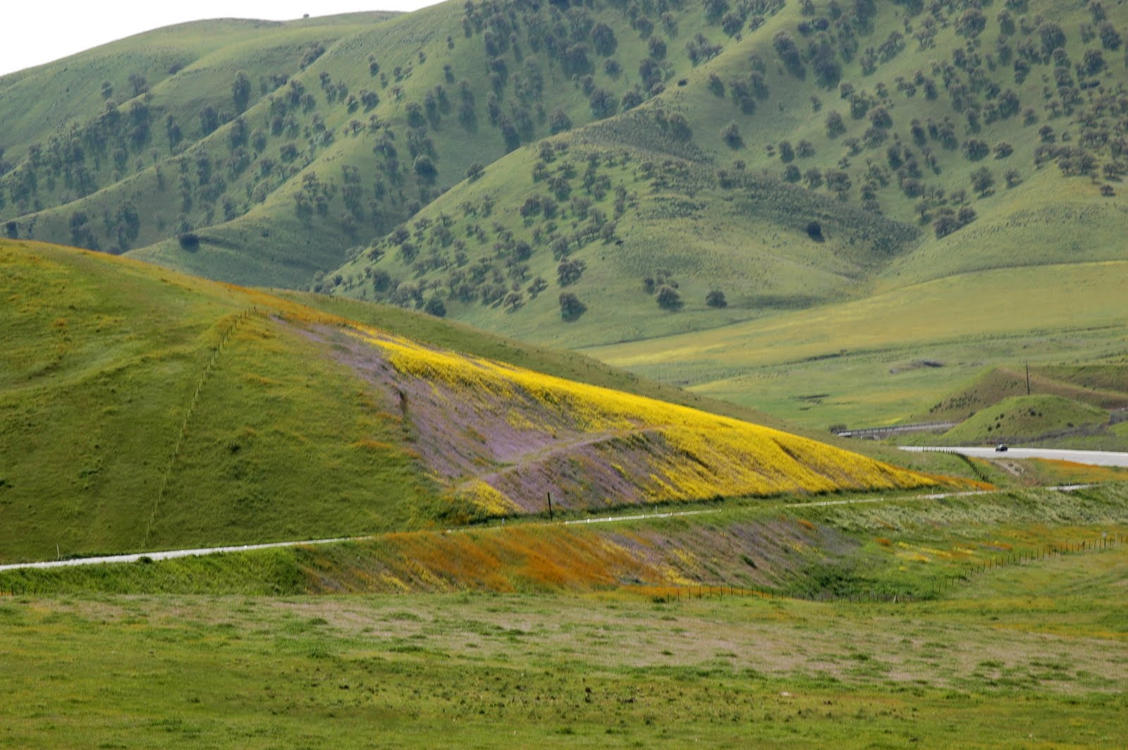
The burnt orange and yellow, was finally accompanied by purple and blue, with bright green grass patches of the winter-rain soaked hills.

Splashes of Yellow, Burnt Orange, Blue, Purple, and Green
As the hills and fields increased in the number of colors, we got closer and closer to the interchange with Highway 41, which seemed to center around the best wildflower displays. The hills flattened out a bit in a valley and the flowers stretched out over flat pastures and fields. Most of the yellow splashes were not mustard, but we did come upon a magnificent field of mustard with the highway winding its way back into more hills, with promise of more amazing scenery.

A Field of Mustard, As Hwy-46 winds back into the hills.
We continued our drive through these hills, where there were very few opportunities to pull the car over. We did start to see stretches of the intensely bright orange California Poppy. These tall hills were also dotted with the newly leaved oak trees.
A purple and yellow hillside with a Oak tree dotted backdrop.
The bright orange California Poppies began to mix with a small white flower. These two flowers seem to really like each other, as I saw many instances of them together on this trip.

Orange and White together
After we descended from the hills, Highway 46 flattened out into another valley. Occasionally, large hills would still arise on the south side. Many of the fields that covered the space between us and the hills were full of wildflowers.
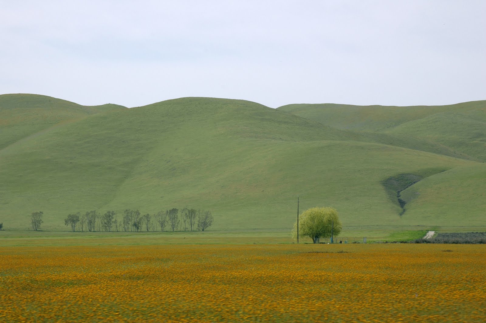
A Field of Fiddlenecks
In the town of Lost Hills, we turned down Woodward Street, and continued south. Eventually this road joined with Highway 33. When the road ended, we went west on Highway 58, toward the town of McKittrick. There, I was shocked to discover mass amounts of oil drills. It was startling after driving through vinyards, rolling hills, stretches of wildflowers and occasional almond orchards.

Backroads on the way to McKittrick
McKittrick is very small and nothing to write home about, in fact, it is not too wonderful. It is flanked by oil drill fields. But these fields dried up and as we continued on Highway 58 and west again, the hills reappeared and so did the wildflowers.

Rolling Hills and Wildflowers along Highway 58
We were heading west again so we could visit Carrizo Plain National Monument. The rest of Highway 58 and the national park is Part 2 of the Wildflower Safari!
The Details:
Photographs: To see more of my photographs of this portion of the trip, visit:
Highway 46
All rights reserved.
Accommodations: Motel 6 - Paso Robles (just off Highway 101 and Highway 46)
1134 Black Oak Dr., Paso Robles, CA 93446
Motel 6 Paso Robles
Route:
From Black Oak Drive (Motel 6):
1. Left onto 24th St and enter Highway 46 East, continue for about 60 miles.
OR
From Highway 101 S:
1. Take exit 231B for CA-46E toward Fresno/Bakersfiedl, continue for about 60 miles.
2. In the town of Lost Hills, make the 3rd right onto Woodward Street, which turns into Lost Hills Road. Continue about 12 miles.
3. When the road ends, turn Left on Highway 33 South/West Side Highway for 10 miles.
4. Highway 33 joins Highway 58/Blue Star Memorial Highway (or a slight right), just before the town of McKittrick.
5. About 2 1/2 miles after joining Highway 58, during which, you will pass through the town of McKittrick, turn slightly right to continue on Highway 58 W/Blue Star Memorial Highway, leaving Highway 33.
Map:
View Larger Map
No comments:
Post a Comment